Ink & Iron
1805 Europe strategy map — illustration plus engine-ready province data
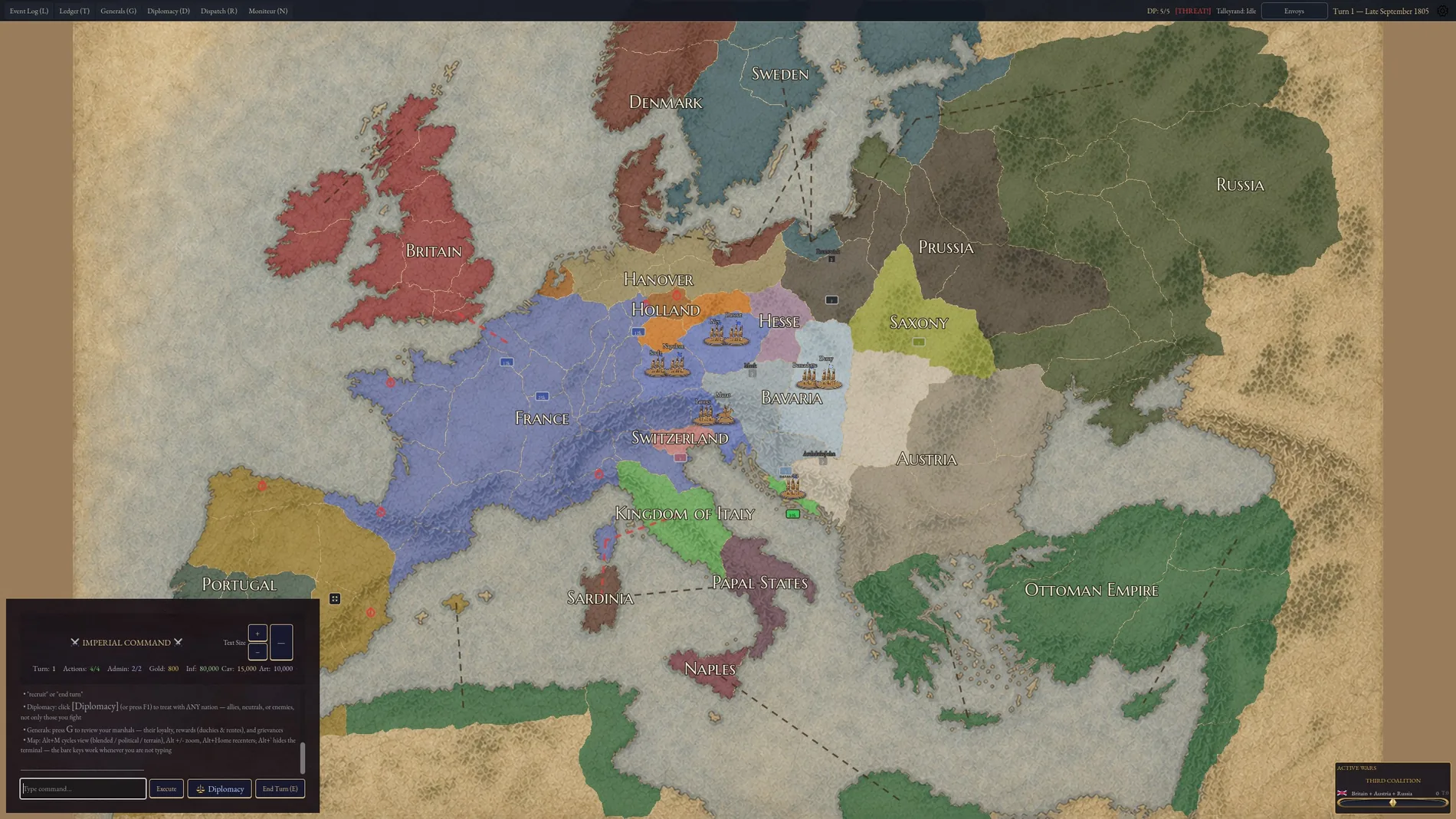
A Napoleonic-era strategy map of 1805 Europe in an EU4/Paradox idiom. Combined a high-resolution illustrated historical terrain map with technical province assets: borders, unique flat RGB province bitmaps for engine region identification, and structured data.
Two layers, one registration. The illustration has to read as a period map; the bitmap underneath has to be pixel-exact so the engine can identify every province at runtime.
I created the 1805 Europe map for Ink & Iron: Napoleonic Wars, combining the look of a historical strategy map with the precision needed for game production. My work covered terrain artwork, province borders, a uniquely colour-coded province bitmap, and structured region-to-colour data.
02 plates from the production.
Select any plate to inspect at delivery resolution
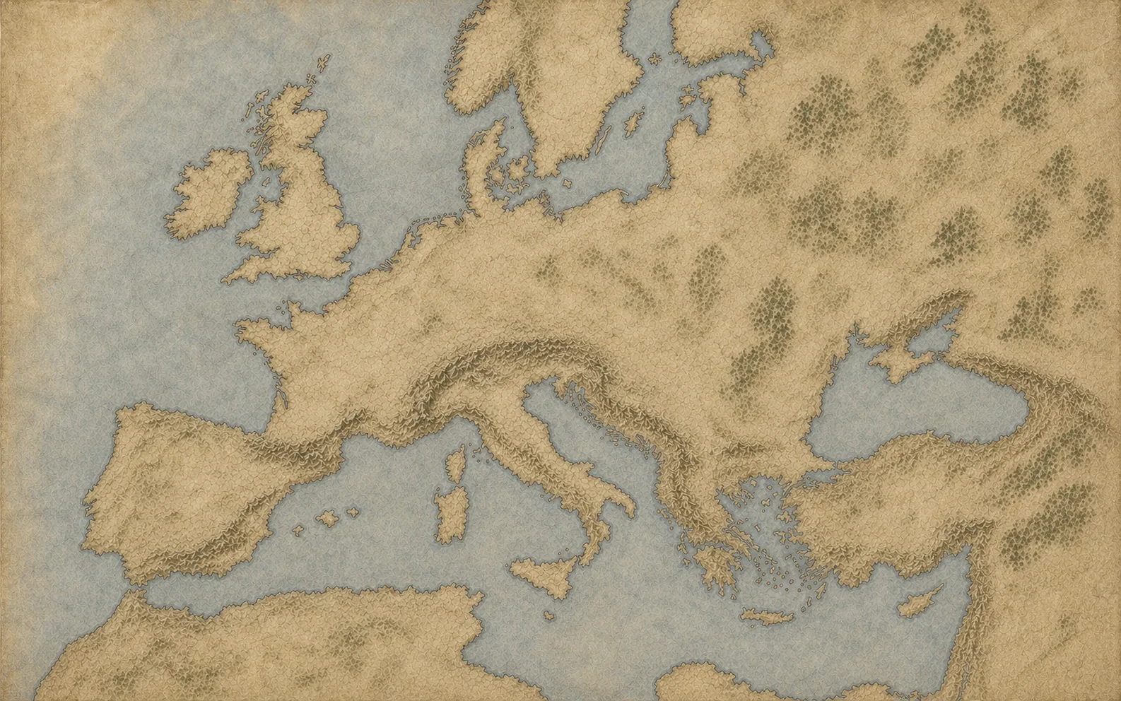
Antique parchment styling with relief ranges and river networks.
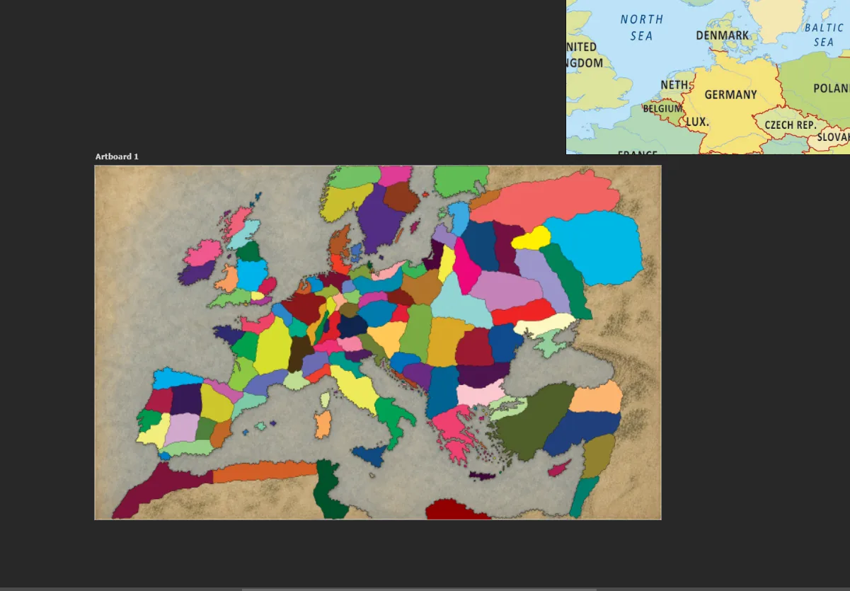
Flat, unblended colour encoding for pixel-exact region identification by the engine.
Need this kind of
art in your build?
Send the project, the platform and the rough shape of the deliverable. You'll get back a direct read on scope, pipeline and handoff.